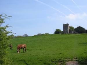
The effort expended on the ups and downs of this walk is rewarded by gorgeous views and find countryside.
| Distance: | 15.4 Miles | |
| Est. Time: | 7 hrs 00 mins | |
| Difficulty: | Moderate | |
| OS map: | Explorer sheet 167 | |
| Total Ascent: | 1499 ft | |
| Total Descent: | 1814 ft | |
Register to create & share your own walks
Highlights
- Horton Court
- Somerset Monument
- Kilcott
- Magnificent views
This second section of the Cotswold Way national trail brings you into more typical Cotswold scenery and some pretty stiff uphill sections (yes, pretty and stiff). If you are using the Cotswold Way map, which is a handy accompaniment to the Way, you will find several points where it diverges from the signposted route – so watch where you go.
The Route 

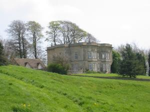
Follow the path diagonally right towards a stream and a gate. Go through a double gate and bridge crossing the stream. Follow the way markers alongside a fence and a line of trees continuing up the hill and keep going by that fence until you spot a marker, in the middle of the field, pointing towards a kissing gate (GR757800), which you go through. This is a really pretty piece of parkland with traditional trees and some ornamental ones ranged across beautifully landscaped grassy slopes. Follow the fence on the left hand side of the field towards a Cotswold Way marker and a fine copper beech tree. To the left from this point you can see the lake and glimpses of Doddington House. Cross a small bridge, veer left to go through a gate, then cross the drive that leads to the house and veer slightly left towards another gate and a kissing gate beside it. Go through the kissing gate and turn right onto a road, called Catchpot Lane, leading to Old Sodbury (GR753805). Follow the road up the hill past some cottages and immediately turn left to follow a footpath across a field, through a gap in a hedge and on to a kissing gate (you can see 2 gates across the field and it is the left one that you want).
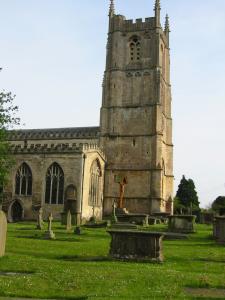
Walk through Little Sodbury and past St Adeline's church ad immediately turn right (GR757833) [The Cotswold Way sign can easily be missed because you can't see it until you have already turned the corner!]. Approximately 75 yards up the road turn left onto a footpath leading beside a house, over a stile and across a field. Go over a stile and under some power lines, the follow the curve of the path round to another stile, then go steeply down into a valley and even more steeply up the other side to a gate and stile between two hawthorns. Notice a large manor house on the hill ahead to the right.
Go over a stile and along a path between hedges, through a gap and turn right onto Widden Hill, the main street of the village of Horton (GR762843). Come up to Horton school and turn left, following the sign to Horton Court and Cotswold Way, then turn right onto a footpath leading uphill beside the school and go through a kissing gate then steeply uphill and through another kissing gate. [This is another point where the Cotswold Way signs disagree with the Cotswold Way map, which would have you stay on the road the views from the footpath are better.] Go past a tower built of new stone, which is actually a folly built as a millennium project to encourage swallows and barn owls to nest there. Just after the tower the path turns left through a kissing gate to move away from the manor house grounds but pause to enjoy the view before moving on.
Follow the path diagonally across the field to the left hand end of the bank opposite. At this point you begin to see across the valley to two prominent landmarks further up the Cotswold Way the Somerset Monument (at Hawkesbury) and the Tyndale Monument (at North Nibley). Follow the path along the left hand side of the field, passing a seat (which is a convenient point from which to enjoy the magnificent view with a drink and a sandwich). Continue along the field edge to a kissing gate in the corner, from where you go steeply down a zigzag path through woodland (which is carpeted with wild garlic and bluebells in season). At the bottom of the zigzags go through a wooden kissing gate and turn right. Walk a short way uphill then turn left to follow a broader, more level path.

[An alternative option at this point is to divert to Hawkesbury Upton by following Highfield Lane. The village is not scenically significant but it does offer facilities for refreshment and accommodation. But there is a second opportunity to divert by footpath further up Bath Lane]
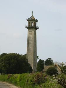
Near the top of Bath Lane a footpath on the right leads into Hawkesbury Upton, but the main route leads straight ahead then turns left onto the road out of the village and towards the Somerset Monument. A short way before the monument there is a permissive footpath to the right, allowing you to cut off a corner on the route, but the main route turns right just beside the monument (GR773876) through a kissing gate to join a broad path towards (the Tyndale Monument is now clearly visible across the valley).The path goes along Long Combe towards Lower Kilcott. Be ready for a sudden change when the route turns sharp left to go off the ridge (GR780823). [Yet again the way markers disagree with the map, which suggests that you stay on the broad track but this may be a recent revision.] Go down the hill alongside the woods and through a gateway where you turn right onto a bridle path. Veer slightly left at a junction of paths, go over a stile and then along a sunken track until you reach a road at Lower Kilcott GR789890). Turn left onto the road opposite some cottages.

This pretty valley is at Holywell, a name that indicates that this watery area must have been regarded as sacred in ancient times. Turn right onto a small road in Holywell (GR764973) and follow the road steeply up to the B4058, where you turn left to walk down into Wotton-under-Edge. [The Way actually follows a footpath loop into Wotton but the B4058 has a pavement and I favour the shortcut at this point.] End at the Car Park behind the Civic Centre/Library at GR756934
Safety 
Much of this section is easy walking but some sections are steep and demanding. But it is all footpaths, bridleways and roads (no rock scrambles) and the most risky parts are the busier road crossings. Expect soft going in some sections following periods of rain.
Notes 
Hawkesbury Upton is undistinguished historically or architecturally, but it offers a couple of pubs and some shops that you may find useful. Its major attraction is the Somerset Monument, which is actually outside the village.
Lower Kilcott has no facilities for the walker, but it is a pretty spot to gaze and and photograph. The farm has a fishing pond that attracts some traffic.
Somerset Monument - This 100 foot high monument was erected in memory of Robert Edward Henry Somerset, a general at the Battle of Waterloo (1815). He survived the battle and died in 1842.
Wotton-under-edge - This market town is very much on the edge, with a high scarp face of the Costswold hills looming over the town. In medeaeval times it was heavily involved in the rich wool trade and is mentioned in a royal charter of King Edmund of Wessex dated AD940. It offers a fair selection of pubs, restaurants accommmodation and other facilities.


