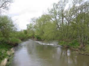
Following the Wye from Hereford, this section also passes the River Lugg (much more beautiful than its name!)
| Distance: | 7.2 Miles | |
| Est. Time: | 3 hrs 10 mins | |
| Difficulty: | Easy | |
| OS map: | Explorer sheet 189 | |
| Total Ascent: | 531 ft | |
| Total Descent: | 551 ft | |
Register to create & share your own walks
Highlights
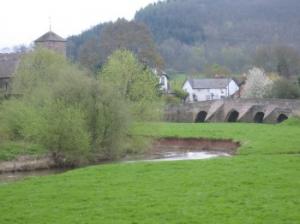
 Mordiford Bridge (River Lugg)
- Common Hill Nature Reserve (SSSI)
- Lea and Paget Woods (SSSI)
This section of the Walk runs through or alongside two Sites of Special Scientific Interest and several other beautiful views.
The Route 
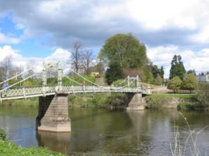
 Resume the walk at Wye Bridge, following the path through the riverside park to Victoria Bridge, an iron suspension footbridge.
Cross the Wye to the site of Hereford's former castle and turn right, following the riverside path. Turn away from the river where the metalled path turns left. Follow Vicarage Road past a school to a T-junction and turn right, then shortly after that turn left into Park Street. Almost at the end of Park Street, turn right into Crozen Street, left at the railway embankment, then right onto the main road and under the railway bridge. You are close to the Wye at this point but it can only be glimpsed occasionally.
Walk up past the Salmon Inn, pas Plas Gwyn (former home of Edward Elgar, the composer). Continue past Hampton Grange (Nursing Home) and Litney Court. About 200 yards past Elgar's Oak turn right through a kissing gate onto a metalled footpath passing through a housing estate. Cross an estate road (through kissing gates on both sides of the road) and continue along the footpath. Go through another kissing gate next to an electricity sub-station and walk across a field to the river bank. The riverside path goes through 3 kissing gates then, at the 4th gate, the Wye Valley Walk turns left, away from the river.
Go over a narrow footbridge, crossing a ditch, then mount the flood bank and pass through a kissing gate. Walks along the bank behind houses and a paddock and go through another kissing gate, down some steps and right onto the B4224 road. Cross to a lay-by (with a telephone box) and turn left over a stile onto a footpath. Walk across a field towards a weeping birch tree and a large oak beside some houses.
Cross a stile and walk between 2 hedges to a road, where you turn left. Follow the road as it bends round to the right and continue along the same road as it passes fields and houses. Ignore footpaths to the right and left and remain on Rectory Road to the end, where the route turns left and goes up a track, then turns right through a double gateway onto a broad footpath.
 Follow the footpath along the flood bank of the River Lugg all the way to Mordiford Bridge, a beauty spot where the B4224 crosses the River Lugg on the way into the village of Mordiford. Go over a couple of stiles to reach the road then cross the bridge into Mordiford. At the Post Office turn right onto a footpath. Cross a footbridge and turn left; walk up an unmetalled lane, cross a road and walk through a mill-yard. Go through an iron gate, past barns, over a small stream and through another iron gate. Go along the right hand edge of a field to a stile; turn right across a stream and walks up the right hand edge of an orchard to a stile in the top right hand corner. Follow the path between edges up to a house, where you turn left onto a bridleway, much of which is metalled.
At Hope Springs turn right alongside a stone barn and walk through a farmyard. Follow the path past a line of trees, through a gate, along a field edge and through another gate. Cross a stile, head directly across a field and drop down through a gate onto a roadway. Cross a concrete bridge to come out onto a road at Nupend.
You can end the walk here and follow the road down into Fownhope, returning to this point for the next stage of the Wye Valley Walk. An alternative option is to drop off most of your luggage at your accommodation and take the next stage as a loop-walk bringing you back round into Fownhope.
To continue the walk cross the road and join the bridle path leading up through woodland. Keep to the bridleway, ignoring cross paths and following the blue arrows. Views of Fownhope and the Wye can be seen on the right. The path then drops down to pass behind a house, then continues down to cross other tracks before rising up again alongside Common Hill Nature Reserve (the unmetalled road on the right is another possible route down into Fownhope).
A little further up the hill, the Wye Valley Walk branches right, leaving this bridleway, crossing a stile into another section of the Common Hill Nature Reserve (designated as a Site of Special Scientific Interest). Cross the field and go up some steps to a viewpoint before heading further along the ridge. The path sinks between banks (an indicator of a probably ancient route). Cross a stile and walk down to a driveway and out to a road (a possible third route into Fownhope).
Cross the road and go over a stile; follow the left hand edge of a field round to a gate and stile leading into Lea Woods. This section of the walk passes through Lea and Paget Woods, which is a haven of wild flowers (and another designated SSI).
In the woods, at the junction of 5 paths, turn right following the yellow arrow. At the viewpoint at the end of the woods, cross a stile into a field. Keep to the right hand side of the field and walk down to where the next stile is hidden in the bottom right hand corner. Continue along the right hand edge of the next field and cross another stile. Continue down the right hand side of another field to an iron gate. Turn left and follow the field edge right round and up to a stile at the top.
At this point the route has been changed. The next signposted stile is diagonally left across the field, but the sign here points right, leading you to a new stile. In either case, they lead to a farm track, where you turn left and walk down to the B4224 road. Turn left onto the road and shortly turn right onto another farm track at Caplor Farm. Just before you reach the farm buildings turn left over a stile and pass behind the farm buildings.
Go through a gateway and on up to another gate and stile, from where the path leads steeply uphill through woodland. At the top of the steps, the footpath sign on the stile points right; in fact, the proper route is almost straight ahead, but walking half-right (to the right of a building) brings you into the middle of Caplor Camp Hill Fort. Cross the banked enclosure to a gap on the left, marked by a stump and a concrete emplacement.
Pass through the gap and turn right to rejoin the main route - a broad track leading downhill. Look out for, and follow, a footpath on the left passing through a stand of conifers. The footpath rejoins the track, where you turn left and continue downhill to a road at a point just above the Capler Hill Viewpoint (a short way left along the road).
This is the point where the alternative circular walk turns back to Fownhope to resume next day.
Safety 
With a few more ups and downs, this section is less easy but still pretty safe. Again, there are some road crossings where care will be needed.
Notes 
Caplor Camp Hill Fort (Capler Camp) Note that the different spellings are not our mistake. Both versions appear on the map and signs and reflect changes over the years. The 'camp' is the site of an Iron Age Hill Fort.
Common Hill (near Fownhope) is designated as a site of special scientific interest (SSI) and justly so. This hillside area of semi-wild grassland boasts in heartening display of tradtional wildflowers. The cowslips are particularly impressive in season.
Foy Bridge is a stylish footbridge close to Hole-in-the-Wall.
Hereford - The "ford" element of the name gives away that the river crossing was the original impetus to creating this settlement (actuall meaning "ford of the army"; but it has had a long history since then. The cathedral is its most noticeable feature today and it is worth a visit to see its impressive architecture and the famous "Mappa Mundi" (part of a chained library). Nearby Wye Bridge gives a good view of the cathedral and is an ancient structure itself. The park beside the bridge (opposite the cathedral) leads to an iron suspension bridge (Victoria Bridge) from where you can cross back over the river to a mound that marks the site of the former Castle. On your way out of Hereford (in the Ross-on-Wye direction) you pass a house called "Plas Gwyn", which was the home of Elgar, the composer.
Lea & Paget Woods - Designated as sites of special scientific interest (SSI) it is not easy to tell where Lea Wood ends and Paget Wood begins. But, whatever the name, you should be impressed by the unspoiled nature of these deciduous woodlands. They have a lot of wildflowers (especially in Spring) and many woodland animals (though you are unlikely to see any whilst walking during daylight).
Locksters Pool - The Wye is a good salmon river and Locksters Pool has a reputation as a good spot for catching these fine fish.