This final section includes the highest cliffs on the walk and continous views across St Brides Bay.
| Distance: | 8.7 Miles | |
| Est. Time: | 4 hrs 00 mins | |
| Difficulty: | Easy | |
| OS map: | Explorer sheet OL36 | |
| Total Ascent: | 988 ft | |
| Total Descent: | 1119 ft | |
Register to create & share your own walks
Highlights
- St Brides Bay with views towards St David, including Stack Rocks and Ramsey Island.
- St Brides
- Magnificant cliffs.
From Martins Haven to Broad Haven you have St Brides' Bay constantly in view. This section includes the highest parts of the walk.
The Route 
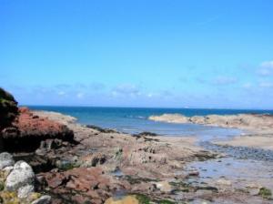
 Set out on the road towards Martins Haven almost as far as Marloes Beacon, retracing yesterday's route. Cross a stile to the footpath on the right leading out to the Coast Path. The path follows the edge of the field. At Black Cliff turn right and follow the Coast Path over the stream and up the hill above Musslewick Sands. Cross a stile then walk along the edge of a field to another stile. Walk along past Quarry Pit and a headland notable for its pink and grey stripes. Cross another stile and continue towards Tower Point (headland). Cross a stone stile and walk alongside a wall (at this point Skomer can be seen to the left). As you approach the end of the wall you will catch your first glimpse of Stack Rocks (to the right) threatening shipping in St Brides Bay.
Go through a gap in the wall then through another gap in the adjoining wall. Follow the wall behind The Nab Head, Huntsmans Leap and Castle Head. The Castle at St Brides is visible on the right through occasional gaps in the wall. St Brides Church comes into view as you continue to follow the wall until the path crosses a stile to take you inside the wall leading down to St Brides Haven.
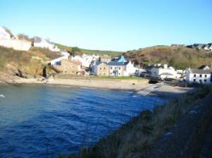
Cross a stile/gate to a grassy area with several picnic tables and benches overlooking the haven. The Coast Path continues to the left of a row of slate roofed white cottages (go through a kissing gate).
 There are several choices of path here depending whether you want to walk round every little headland or cut across. Cross a stile and walk behind the inlet known as The Falls. Cross the stream. Walk beside a wall/bank and round the top of Warey Haven. Pass through two kissing gates (they replace a bridge and stile that got too near the cliff edge). Go past Halfway Rock and follow the path between two fences. Cross a wooden footbridge; when you go round the corner you will be able to glance back and see a small waterfall. You are now at the closest point to Stack Rocks. (Notice the camel-like profile of and arch and stack formation on the left of these rocks)
Pass a mounted pink stone with a hole carved in it and walk down the valley to cross a footbridge over a stream. Walk behind a stony beach and up the hill to the cliff top. Notice that the geology has changed and you have left the pink rocks behind for more durable granite… hence the higher headlands (this is the highest section of today's walk and of the whole peninsular).
 Pass a large white rock with a pink stone mounted on top and carved with concentric rings. Continue on up behind Howney Stone and Tickles Point. Pass a large white rock above the headland (Tickles Point). Cross a stile, go through a kissing gate and walk up Borough Head on a path between the hawthorn bushes. Walk through woodland (impressive with bluebells, in season). Pass a stone seat on a viewpoint looking out across St Brides Bay.
Pass a footpath that leads right to the Talbenny Road. Go through a kissing gate and turn left onto a road. After 100 yards turn left back onto the Coast Path. Pass a viewpoint adjacent to a road/lay-by. Follow the twists and turns of the Coast Path until it takes you down steps to Little Haven harbour. Come out at the head of the harbour, cross a bridge over the stream near the Castle Hotel. Walk past the hotel and follow the road signs over the hill to Broad Haven.
Safety 
Nowhere is this a particularly difficult walk, but walkers may choose to take it steadily over 4 days or step out for the 3 day version. The overall distance is 33 1/2 miles made up of -
Broad Haven - Dale - 10 miles
Dale circular walk - 7 miles
Dale to Marloes - 7 1/2 miles
Marloes to Broad Haven - 9 miles
Notes 
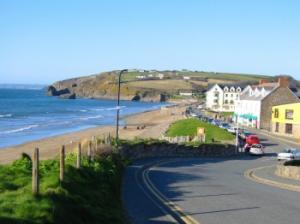
 Broad Haven - a coastal holiday village with two good pub/restaurants and several shops. A broad sandy beach bounded by cliffs and looking out across St Brides Bay.
Little Haven - a small, picturesque harbour and village situated at the southern end of St Bride's Bay. Little Haven has several pubs and restaurants and a public car park.
 Marloes - the second largest community within this peninsular and the closest to the island of Skomer, focus of much of the tourist activity in this area. Nearby, Marloes Sands is a broad, sandy beach, which is rarely full and is also good for surfing.
Martin's Haven - a small shingle-beached bay, surrounded by high cliffs, but sufficiently sheltered to be the embarkation point for Skomer ferries. Ferries leave for the island at 10.00 a.m., 11.00 a.m. and 12.00 noon. A gift shop stands on the cliff top near the National Trust car park.
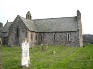
St Brides is a tiny village with an attractive church looking out across St Bride's Bay towards St Davids. A few handy picnic tables above the beach make it an inviting place for a breif rest on the way.