A peaceful clifftop walk with stunning views of beaches and islands.
| Distance: | 7.1 Miles | |
| Est. Time: | 3 hrs 20 mins | |
| Difficulty: | Easy | |
| OS map: | Explorer sheet OL36 | |
| Total Ascent: | 866 ft | |
| Total Descent: | 764 ft | |
Register to create & share your own walks
Highlights
- more cliffs and seascapes with wonderful wild-flowers
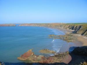
- the lovely beach of Marloes Sands
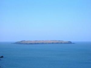
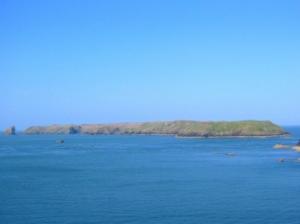
- Skomer and Skokholm islands - two of Britain's best seabird colonies
This section of the walk never leaves the clifftops and the islands are constantly in view.
The Route 
 Leave Dale on the one-way road signposted for Milford Haven. Walk as far as Dale Castle then turn left onto the lane behind the Castle. Cross a stile and walk across the field to another stile at the top of Westdale Bay. Skokholm Island lies straight ahead. Turn right onto the Coast Path and walk up the hill to the cliff top. Follow the path round past the concrete remnants of a disused airfield. Walk down into a valley, cross a wooden plank bridge over a stream near some cottages then walk up the other side of the valley. Cross a stile next to more remnants of the airfield. The island of Skomer should now come into view and, in good conditions, you may also be able to see Grassholm on the horizon midway between Skokholm and Skomer. As you approach the next headland you will see Gateholm Island (actually only separated from the mainland by the highest tides).
The next bend brings you to the overlook looking down onto the broad sweep of Marloes Sands. The disused airfield is still apparent on the right. Cross a stile and walk between two fences then continue along the cliff path to another stile, which takes you into a field.
Walk along the field edge to the next stile. Cross a wooden plank footbridge then a concrete slab bridge near where a footpath leads left down to the beach.
Continue straight ahead and follow the path down into a river valley, over a stile, across a footbridge then go up the steps on the other side. At the top cross another stile and past a stile on the right above Raggle Rocks at the start of another footpath (walkers doing the walk in 3 days can turn off here to go to the Marloes Youth Hostel or a B&B in Marloes village. Pick up from here on Day 3.)
 Continue round the cliff path to come alongside Gateholm (a path leads off to the right towards Marloes). You will now see your best views of Skokholm. Continue on the Coast Path (past another path to Marloes) and notice a waterfall plunging over the cliffs to the left. Cross the stream by means of stepping-stones. You are now in the National Trust Marine Nature Reserve. Follow the diversion signs where the old path has become too eroded. Above Dead Mans Bay, take time to enjoy superb views of the islands.
Head towards a white cottage, go through a gate, over a bridge and follow the path round to a kissing gate leading into the National Trust reserve of Deer Park. Walk parallel to the wall and go back through a kissing gate and turn left onto a small road that leads down to Martins Haven (the embarkation point for Skomer ferries).
Across St Brides Bay you should now see St David's Peninsula and Ramsey Island. Go up some steps on the right to resume the Coast Path via the National Trust Reserve of West Hook Farm. Pass another footpath leading right (over a stile) to Marloes Road. 150 yards further on cross a stile marking the end of the West Hook Farm reserve.
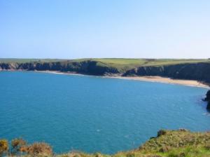
At the next stile a signpost points off to farmhouse accommodation (East Hook). Cross another stile and enjoy the view down to Musselwick Sands. Go over another stile above the start of the sands. (A table and benches conveniently placed on the cliff top above Musselwick Sands provides a handy rest point.) 4-day walkers should turn off at this point following the footpath signs to Marloes - (1 mile). The path follows a field edge and turns right, then heads straight towards the road. Turn left on the road and walk into Marloes village
Safety 
Nowhere is this a particularly difficult walk, but walkers may choose to take it steadily over 4 days or step out for the 3 day version. The overall distance is 33 1/2 miles made up of -
Broad Haven - Dale - 10 miles
Dale circular walk - 7 miles
Dale to Marloes - 7 1/2 miles
Marloes to Broad Haven - 9 miles
Notes 
 Marloes - the second largest community within this peninsular and the closest to the island of Skomer, focus of much of the tourist activity in this area. Nearby, Marloes Sands is a broad, sandy beach, which is rarely full and is also good for surfing.
Martin's Haven - a small shingle-beached bay, surrounded by high cliffs, but sufficiently sheltered to be the embarkation point for Skomer ferries. Ferries leave for the island at 10.00 a.m., 11.00 a.m. and 12.00 noon. A gift shop stands on the cliff top near the National Trust car park.
This is also a popular starting point for diving trips.
 Skomer - its Danish name betrays the Viking interest in this area. But the seafarers who land on Skomer these days have usually travelled just 10 minutes by boat from Martin Haven (near Marloes) and have come to see the wildlife. The island hosts puffins, guillemot, razorbills, manx shearwater (Skomer hosts one third of the world population of this seabird) and a host of more common birds, plus grey seals, its own unique vole and (offshore) porpoises, sunfish and turtles.
If time allows you could enjoy a day on Skomer, soaking up the views of sea and wildlife, before continuing this walk.
Skokholm -the next island out, about 6 miles west of Skomer. It looks much closer than that on a clear day, but the boat journey is worth the effort for its variety of bird-life.
Grassholm - further west beyond Skokholm, this smaller island is important for hosting the largest gannet colony in England and Wales.