A mostly moderate climb up a beatiful, tree-clad, mountain; but with a challenging section near the top.
| Distance: | 6.6 Miles | |
| Est. Time: | 3 hrs 50 mins | |
| Difficulty: | Challenging | |
| OS map: | Explorer sheet 406 | |
| Total Ascent: | 2228 ft | |
| Total Descent: | 2175 ft | |
Register to create & share your own walks
Highlights
Old Rag Mountain - height 3,291 feet (1,003 m)
- Blue Ridge Mountains
Situated in the Blue Ridge Mountains within the Shenandoah National Park, this walk gives you a marvellous view over a beautiful and justly popular region.
The Route 

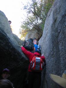
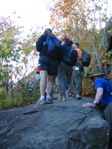
After the trailhead barrier the well-marked path soon turns left and climbs steadily through deciduous woodland, gradually getting steeper until it enters a series of zig-zags. Evantually, the forest path gives way to a rocky section (and I mean big rocks!) where you may encounter congestion. [When I walked it I had to wait 20 minutes for my turn to clamber up the next section]
The next few yards are what defines the climb as "difficult". Up to this point your walk will have been easy; but clambering up these rocks demands hands, feet, stomach muscles and determination. However, you may also find a Guide stationed there to direct your efforts and, if necessary, help you up. This is rarely a lonely trail.

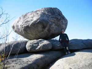
After that, the climb becomes easy again and brings you out onto a broad, rocky plateau from which you can get marvellous views of the surrounding mountains and forest.
Go past the Byrds Nest day shelter to pick up the Saddle Trail leading down past the large Old Rag day shelter to the Weakley Hollow Fire Road. This broad, gravelled path takes you gradually and uneventfully back down to the Ridge Trail trailhead and the road back to the parking area.
Safety 
Most of this walk is easy, but a short section of climb between and over large rocks turns it into something more difficult. Other than that, the risks are low and the popularity of this walking area make it likely that you will have someone nearby to call on if you get into diffuculties.
Notes 
The Blue Ridge Mountains are so called because of their apparently bluish colour when seen from a distance. They are part of the Appalachian chain that runs up much of the eastern United States.
Shenandoah National Park includes part of the "Blue Ridge Mountains of Virginia" made famous by the Laurel and Hardy song. But it is no joke; it is a long, narrow national park with many recreational opportunities. It is bounded by the Piedmont hills in the east and the Shenandoah River in the west.
