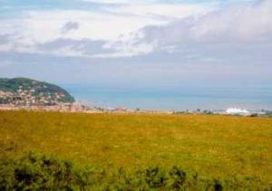
Marvellous views over the Bristol Channel and a brief sample of Exmoor's beauty.
| Distance: | 6.8 Miles | |
| Est. Time: | 3 hrs 20 mins | |
| Difficulty: | Easy | |
| OS map: | Explorer sheet OL9 | |
| Total Ascent: | 1152 ft | |
| Total Descent: | 1204 ft | |
Register to create & share your own walks
Highlights
- Views across Bristol Channel
- Exmoor views
- Pretty village
- Quiet country lane of yesteryear
Sample Exmoor scenery the easy way with this walk along the edge of the moor close to Dunster and Minehead. The route climbs to a ridge walk offering views inland to Dunkery Beacon and seawards to the Welsh coast. On the return you pass along an almost deserted lane - a reminder of how country walks used to be.
The Route 
 Go up the bridle path following the signs to Grabbist Hill. As you walk up through woodland you will catch the occasional glimpse of Minehead Bay. Pass a cemetery and continue to the top of the path, turning left at the T junction.
Follow the path up along the ridge and enjoy the expanding views of Minehead and the sea to the right.
At Grabbist Hill the map marks a feature called Blindman's Well. This is a tiny spring, often no more than a puddle, but sometimes bursting into fuller life to form a stream leading down in the direction of Minehead. To see the spring follow the path leading downhill to the right, then retrace your steps back to the main path.
Continue along the ridge, where views begin to open out in both directions (to Exmoor on the left and the sea to the right). At Holes Corner, near an entrance to forestry commission land, a signpost points south to Croydon Hill, west north west to Selworthy and back to Grabbist Hill. A seat (erected by his friends in memory of Gary Draper) affords the opportunity to survey the view in comfort. Continue in the direction of Selworthy.
At the next crossways (Minehead right, Timberscombe left) continue straight ahead. As you mount higher (if the weather is reasonably clear) you can see across the Bristol Channel to Wales. Cross another path continuing straight ahead along the ridge until you reach a path signposted left to Wootton Courtney. You are now on Wootton Common and at the highest point of this walk 945 feet (291 metres).
Follow the path downhill until it divides into footpath (left) and bridle path (right). Either leads down to the village, but this plan suggests following the bridle path, which winds down through woodland, sometimes giving views of Dunkery Beacon (Exmoor). At the foot of the hill the path comes out to a road beside a large signboard for Dunkery Beacon Hotel. Turn left into the village of Wootton Courtney following the road down beside the 15th century All Saints church.
Continue along the road, past Rainscombe Farm. At Wootton Lodge take the tiny road leading left and slightly uphill. Keep on the same road, which eventually leads back to the layby at the end of Knowle Lane.
Safety 
The pathway to the ridge may be steep for some, but entails no danger nor exceptional gradient. If seven miles is too long for you there are several cross paths to shortcut the route.
Notes 
Blindmans Well - This is a tiny spring, often no more than a puddle, but sometimes bursting into fuller life to form a stream leading down in the direction of Minehead. To see the spring follow the path leading downhill to the right from the Grabbist Hill ridge, then retrace your steps back to the main path.
Dunkery Beacon can be seen from parts of this route. It is a dominant high point on this side of Exmoor, reaching to 1687 feet (519 metres).
Holes Corner - Near an entrance to forestry commission land, a signpost points south to Croydon Hill, west north west to Selworthy and back to Grabbist Hill. A seat (erected by his friends in memory of Gary Draper) affords the opportunity to survey the view in comfort, looking across Minehead out into the Bristol Channel.
Wootton Courtney, with its 15th century All Saints church, is a small village lying alongside a stream. It boasts a number of pretty thatched cottages, which, together with the church and a stone bridge, present many of the ideals contained in the phrase "English village".
Knowle Lane is the beginning and end of this walk and is distinguished for being undistinguished. It is too narrow to become a "rat run" and consequently offers a quietness that is rarely found on modern roads. Walking along this tree-lined lane under the shadow of Grabbist Hill you experience walking as it used to be before everyone could afford a motor car.