I started the walk from Porthcressa Bay in Hugh Town, but the footpath goes all the way round the island and can be picked up at any point on the way. The route mounts clifftops and drops to the beach-side, but is never very steep. However, it is une
| Distance: | 9.9 Miles | |
| Est. Time: | 4 hrs 20 mins | |
| Difficulty: | Easy | |
| OS map: | Explorer sheet 101 | |
| Total Ascent: | 623 ft | |
| Total Descent: | 623 ft | |
Register to create & share your own walks
Highlights
- continuous coastal views
- see all the major islands in one fabulous walk
- ancient burial mounds
- remains of an ancient village
- coastal defences
- sea, sand, cliffs, rocks, woodland and open country
The Route 
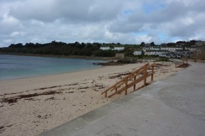
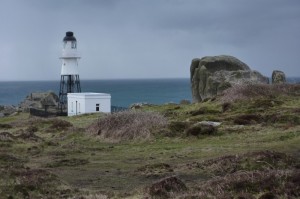
Head southwards along the coast towards the prominent headland of PENINNIS HEAD (GR 910094) which features a small automatic lighthouse.
As you approach OLD TOWN BAY (GR 911100) you pass St Marys Old Church and its graveyard, where Harold Wilson (British Prime Minister 1964-1970 and 1974-1976) is buried. The path comes out on a road, where you follow the pavement around the bay to resume the footpath heading towards the opposite headland (TOLMAN POINT). Go past a path that leads to a restaurant and look out for where the footpath turns left a little before the headland (the path is less prominent at this point).
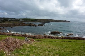
From this point you have a choice of paths, the right-hand one running parallel to the cliff edge and the left-hand one taking a short-cut across the headland. (NOTE: the cliff path leads past an ancient burial mound, but the inland short-cut misses this feature)
The path turns slightly inland then climbs to meet another path at a T junction. Turn right to continue along the coast, then loop left to pass DEEP POINT (small headland) and DARRITY’S HOLE (small bay). At a junction a signpost points to Cairn Vean Tea Rooms; this is a possible diversion if you’re ready for refreshment, but the main footpath continues to the right and drops down to the sands of PELISTRY BAY (GR 927121). Walk across the top of the beach and up a bank to rejoin the footpath and walk past TOLLS ISLAND (which is an island at high tide but connected by bank of rocks at low tide).
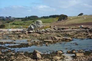
Round the top of the island, passing BAR POINT, then head uphill past PENDRAETHEN (GR 911127). At this point you will see the BBC television tower up on the hill to your left. The path loops round this hill then, as the path levels off, you turn right to continue parallel to the coast.
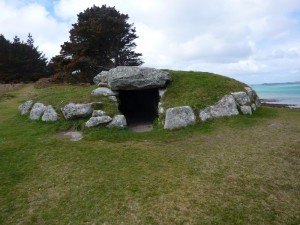
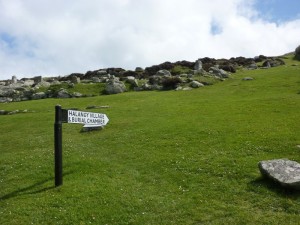
If you detour to wander up through the village you can find a large BURIAL CHAMBER at the top of the site. After you leave this site (at the foot of the field) the footpath splits in to a lower and a higher path; but both paths come together above CARN MORVAL POINT. From this part of the route you get excellent views of two other islands… TRESCO is the larger one, with woodland, and SAMSON is the smaller one, with two prominent grass-covered hills.
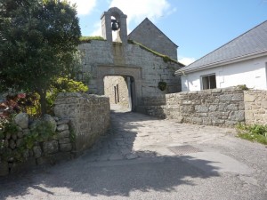
The footpath passes Juliet’s Garden Restaurant, then comes out to the road. Follow the road along to PORTHLOO BEACH (GR 909113) from where you can clearly see HUGH TOWN with its HARBOUR and QUAY. On the coast side of the Boat Park the path resumes briefly and then rejoins the road for a short way, before looping around THOMAS PORTH and back to the road again. Continue along THE STRAND, past a triangular green, past the Town Hall to the centre of HUGH TOWN. Just past the BISHOP & WOLF Public House turn left to follow GARRISON LANE, go past the old Wesleyan Church and up to a junction. Turn right after the POLICE STATION (GR 901105) and then fork left up GARRISON LANE. Follow the road left then pass under the arch of the GARRISON entrance (GR 900106) and uphill past the STAR CASTLE HOTEL.
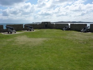
The footpath loops round the headland, passing several coastal defence structures, such as the WOOLPACK BATTERY (GR 898099). In view at this point are the islands of St Agnes and Gugh. The path turns northwards overlooking PORTHCRESSA BAY and widens out to become a track, then a narrow road, passing another coastal battery. Follow the road back round to the archway (GR 900106) and walk back through Hugh Town, past the Police Station (GR 901105) and back to the stat point at PORTHCRESSA BEACH (GR 903105)
Safety 
Outside the streets of Hugh Town, the route barely touches the island's roads. The footpath keeps safely back from the cliff edges and, where is crosses rocky ground, it is not especially challenging. Take reasonable care; wear sensible footwear; and keep back from cliff edges (especially in windy conditions). One point needing special care is the airport, where the footpath crosses close to the start of the runway; warning lights flash and a siren sounds as planes approach and, at all times, you need to cross quickly and not linger at this point.
