Threshfield (Skirethorns Lane, Height Farm, Threshfield Moor)
North Yorkshire, England
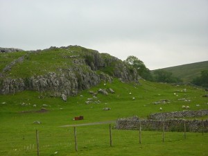
This walk follows a quiet country road up through a classic Dales landscape, then returns via footpaths over moorland and marsh. You will see birds, but may not meet any people on this route.
| Distance: | 5.2 Miles | |
| Est. Time: | 2 hrs 30 mins | |
| Difficulty: | Moderate | |
| OS map: | Explorer sheet OL2 | |
| Total Ascent: | 692 ft | |
| Total Descent: | 686 ft | |
Register to create & share your own walks
Highlights
 Solitude and scenery, with only nature's sounds to break the silence.
Classic moorland scenery.
A glimpse of Height Cave (unfortunately inaccessible on private land).
The Route 
The walk starts on Skirethorns Lane Grid Ref. 982639, which junctions with the B6160 on the north side of Theshfield, North Yorkshire (residents staying on the Caravan Club Wharfedale site can reach the lane via the back exit signposted to Threshfield, those using the Wood Lane campsite can join the route where it passes the site).
Walk along Skirethorns Lane away from Threshfield village. Pass the quarry on the right, then pass a field with a lot of beehives. Turn right into Wood Lane (signposted “Malham 5 miles unsuitable for motor vehicles”). There is also a caravan site sign at the junction.
Go up the hill, past the Wood Nook Caravan site. Pass the gateway/entrance to Heights Farm (GR964647), which contains Heights Cave (marked on OS Map) but, unfortunately, the farm does not allow public access. From here on you are likely to see and hear typical moorland birds such curlews, lapwings and ringed plovers. Green woodpeckers can also be seen in this area.
Cross a stile on the left (GR960650) to join a public bridleway, signposted “Boss Moor 2 miles”. Walk across the field, go through a gate and continue on the path, then go through 2 more gates close together following the bridle way signs. Cross a boardwalk and go through another gate, continue across the moor follow the path right and go through another gate (GR956639). The path goes between dry stone walls with a view of a distant lake on the right.
Pass through another gate at GR957633 and turn left, following the footpath sign to Skirethorns Lane. This is a poorly defined path across marshy heathland and it is easy to lose the way. There are markers in the shape of short, white rods, but they are infrequent. As a general rule, keep in sight of the dry-stone wall on the left. Head eventually for a step stone stile over a dry-stone wall at GR966635. Continue from there across somewhat more even ground; the path is still poorly defined, but look out for waymark wooden posts with their tops painted yellow.
Follow the path through a gap in the wall at GR970636 and continue across the field. Go through narrow wooden double gates and continue along the edge of the field. Pass through a gate and turn right onto a track at GR973637. The track comes out opposite the end of Skirethorns Lane (junction with Wood Lane) from where you can retrace the path back to the start.
Safety 
The first section is on roads that are normally very quiet. But beware of drivers who think the road is clear and drive too fast. The most difficult section of the walk may be the return walk across the moor back towards Skirethorns Lane; this peat marsh absorbs a lot of water and may be quite boggy after rain. Try to keep to the ill-defined footpath (look out for yellow markers) and watch your step!