A pleasant stroll through the Somerset countryside with glimpses of Glastonbury Tor.
| Distance: | 5.5 Miles | |
| Est. Time: | 2 hrs 40 mins | |
| Difficulty: | Very easy | |
| OS map: | Explorer sheet 141 | |
| Total Ascent: | 659 ft | |
| Total Descent: | 659 ft | |
Register to create & share your own walks
Highlights
- Views of Glastonbury Tor
- Woodland scenery
- Historic church
- Commanding views from ridge walks
Close to historic Glastonbury, the rolling hills and vales of this part of Somerset display the greenness that is forever England. Unfortunately, the waterfalls marked on the OS map are in stretches of the Bradley Brook that are private and enclosed. Nevertheless, this is a delightful landscape and you may be lucky enough to see wild deer and a variety of field and woodland birds.
The Route 
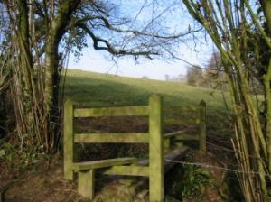
Walk back to the junction and cross the road to a stile (564370). Cross the field in a northeasterly direction to the right hand corner of the field where trees line steep and narrow river valley. Go over a stile and cross a narrow bridge over the Bradley Brook. Walk up the bank and cross another stile into a field.  Continue in a northeasterly direction roughly parallel with the line of trees and some posts. Continue up to the corner of the field and cross a double stile (567374). Cross the field to another double stile and walk across a field parallel to the trees following the brow of the hill. The next stile is beside a metal gate (569375). Cross a field to another gate. Go past a plantation of young trees and follow the footpath between brambles to a stile and bridge. (569376).
Continue straight ahead across a steeply sloping field. Head to the left of the line of trees, keeping to the open field just above the trees, until you reach a stile in the corner of the field (570379). Cross that double stile and walk a few paces along, then turn right to cross another stile and bridge. Turn left and walk up the side of the field to a stile in the top left hand corner, next to a barn. Cross the stile and turn right onto a lane (4549381). Follow the lane to a road junction and turn left (577380). Walk past Combe Hill Farm and continue to the entrance to Pennard Pill Farm; on the left, opposite that farm entrance, go up the bank to a stile (using some rough steps) and cross into a field (576382).
Continue straight ahead following the right hand field edge to another double stile. Continue ahead to a single stile in the corner of the next field.
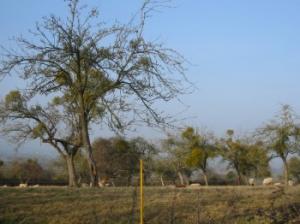
The next field is rather wider and the next double stile comes at a dog-leg bend in the fence/hedge before the corner. Cross the stile/bridge and veer left. Go straight across the field and towards some low trees that stand prominently above the line of the otherwise treeless hedge. You will find the next stile hidden just beyond those trees. Continue along the left hand edge of the next field then veer right to the opposite corner and go through a gate onto a lane. Walk along to a junction and continue on the land ahead (565384). Where the road bends right go through a gate and walk straight ahead on a path consisting of a double vehicle track. On a clear day the high ridge at this point offers good view to the right (N). Pass through a gate and continue along a brad track passing a radio tower (558385). Follow the sunken lane down to West Pennard. You will come to a road junction where the view directly ahead includes the unmistakable profile of Glastonbury Tor.
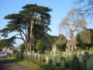
 Turn left through the entrance gate to Pennard Farm and follow the path left towards the church. This partly paved path goes through a gate (crossing another footpath) and along the edge of a field beside the village school. Go through a kissing gate, round the corner of the schoolyard, through a gate and follow the road round past St Nicholas' churchyard. At the end of the lane past the churchyard go through a gate and continue along the edge of a field and round to another gate. Go through onto a narrow lane going alongside a wall then between fences out to a road.
Turn left onto the road and continue through Southdown village passing a number of houses. Follow the road up past the buildings of Southdown Farm and at the crown of the left hand bend turn right onto a lane beside Southdown cottage (558377). You are now on the opposite side of the ridge, which commands broad views to the south. Continue t the end of the lane and go through a gate. Veer left on a poorly defined path and cross the field diagonally to a metal gate.
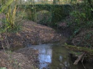
Follow the left hand edge of the next field keeping close to the woods, which line the bank of a steep and narrow river valley (almost a gorge). Continue along that edge to a stile. Cross into the woods and follow the path down into a fern-strewn valley, then up some steps. Continue along to the confluence of two streams, cross the narrower stream and walk up the bank to the bridge you crossed near the start of the walk. Re-cross the bridge, walk over the field and back to the stile (564370) and cross the road to return to the start.
Safety 
This is an easy walk of roughly six miles, mostly over field and footpath with some pleasant woodland stretches.
Notes 


Bradley Brook, as the name implies, is just a small stream, but its effect on the landscape is impressive. It has carved a deep, wooded valley that almost warrants the description of "gorge".
St Nicholas Church, West Pennard West Pennard church is a fascinating example of a parish church separated from its village. It is reached by footpath and lies in a traditional churchyard with ancient yews.